N Dukeland St Complete Streets Resurfacing
What is the N Dukeland Street Complete Streets Resurfacing project?
Baltimore City Department of Transportation (BCDOT) is repaving North Dukeland Street from Liberty Heights Avenue to Gwynns Falls. During the repaving, BCDOT is also adding Complete Streets upgrades. Complete Streets means the street will be designed to be safe and accessible for people walking, biking, rolling, driving, and riding the bus.
The project sits in City Council District 7, and it will connect neighborhoods near schools and parks. As part of the work, BCDOT will add a new multimodal facility on N Dukeland Street. Right now, public engagement for this project will begin in the summer of 2026.
Why is this project happening?
As part of every resurfacing project, BCDOT evaluates the corridor for Complete Streets improvements. These enhancements often include routine upgrades such as adding or refreshing crosswalks, narrowing travel lanes, and installing curb extensions (bump-outs). In some cases, however, the context of the corridor warrants more substantial changes that modify the roadway configuration.
For this project, North Dukeland Street overlaps with a corridor identified in the 2017 Separated Bike Master Plan and is therefore slated to receive additional multimodal improvements. These facilities are intended to support all roadway users—not only people biking, but also those walking and rolling—by creating a safer and more comfortable transportation environment.
These improvements are particularly important for access to Hanlon Park. Currently, pedestrian infrastructure in the area is incomplete, and sidewalks do not fully surround the park. The proposed upgrades will help improve connectivity, accessibility, and safety for park users and others traveling along the corridor, while creating a more comfortable and connected street for all users.
For reference, a map of all resurfacing projects can be found here.
What will the improvements look like?
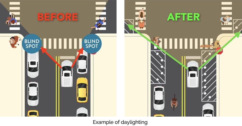
In addition to resurfacing the roadway, this corridor will receive Complete Streets treatments that support safer travel for all users like adding or refreshing crosswalks, narrowing travel lanes, and/or installing bump outs. These treatments such as updated crosswalks and ADA ramps, daylighting, bump outs will improve safety and access.


Multimodal facilities and new on-street parking will also be installed along North Dukeland in accordance with existing plans.
Typical existing cross section Four Travel Lanes | 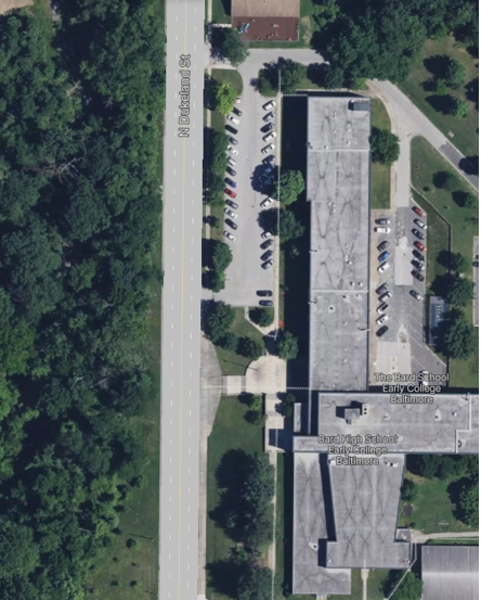  |
Typical proposed cross section Permanent Parking, Two Travel Lanes, and Multimodal Facilities | 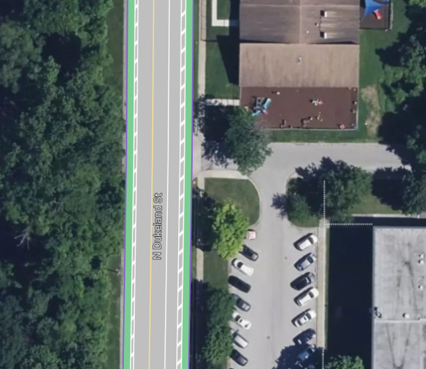 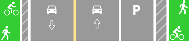 |
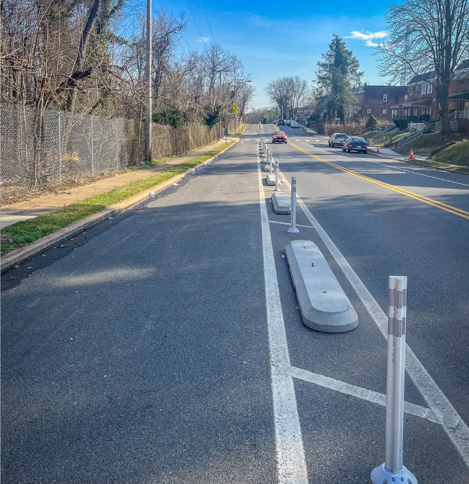
To make a safe and separated path that people of all ages and abilities to enjoy, precast curbs, known as “pills", will be used in conjunction with flex post to create a separated barrier.
Bus stops along the cycle track will also be upgraded with "bus bulbs". These types of stops already exist throughout Baltimore City and provide level boarding access to users, allow the bus to keep in lane, and reduce conflict points, leading to improved boarding time and safety. Below is an example from Harford Road and Kentucky Ave.

Community Meetings and Events
In 2026 between June and September, we plan to attend existing community events and meetings to share project information, gather community feedback, and answer project questions. Below are the meetings and events BCDOT plans to attend.
| Meeting or Event Name | Date & Time | Location | Status |
| Ashburton Area Association Meeting/Event | TBD | TBD | TBD |
| Friends of Hanlon Park Meeting | July 22nd 6:00PM - 8:00PM | Online Hanlon Park Web Page | Attending |
| Greater Mondawmin Coordinating Council Meeting/Event Meeting/Event | TBD | TBD | TBD |
| Panway Neighborhood Improvement Association Meeting/Event | TBD | TBD | TBD |
| Friends of Gwynns Falls Parkway Meeting/Event | TBD | TBD | TBD |
Thank you for your contribution!
Help us reach out to more people in the community
Share this with family and friends