Chinquapin Run Trail
What is the Chinquapin Run Trail project?
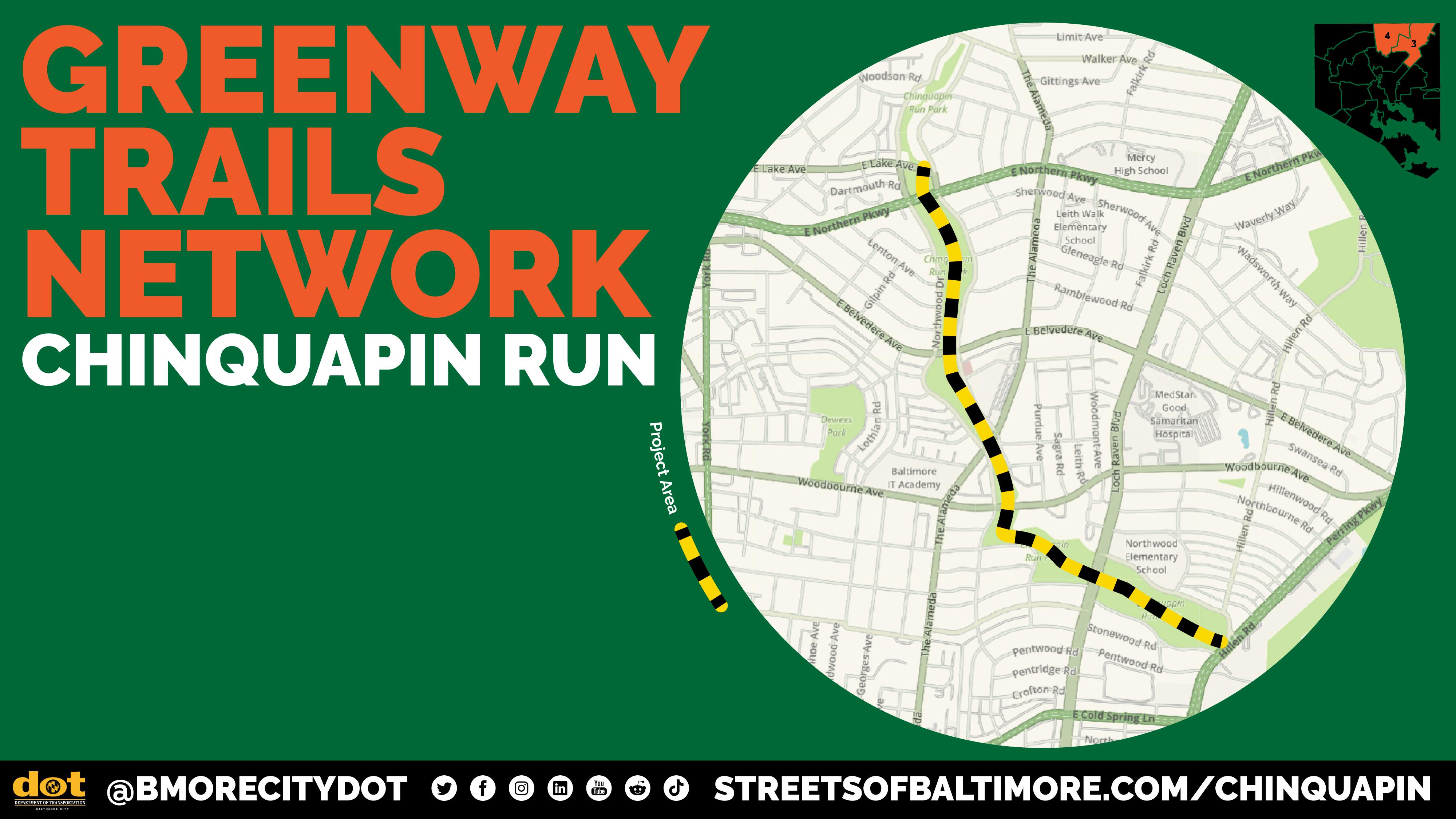
The Chinquapin Run Trail will create a continuous, accessible path along the Chinquapin Run stream between East Lake Avenue and Perring Parkway. The project aims to connect neighborhoods, schools, shopping centers, and recreation areas while improving safety and access for people walking, biking, or taking transit.
When complete, the trail will link Chinquapin Park with surrounding communities, creating new opportunities for recreation, transportation, and connection to nature in northeast Baltimore.
Where will the trail go?

The proposed trail will follow Chinquapin Run, crossing major streets including:
East Lake Avenue
Northern Parkway
East Belvedere Avenue
The Alameda
Woodbourne Avenue
Loch Raven Boulevard
Perring Parkway
Why is this project important?
The trail will make it easier and safer for people to walk or bike between neighborhoods, parks, schools, and shopping areas. It will also provide new recreational opportunities and improve connections to public transit.
By building a continuous trail, the project supports our citywide goals of promoting healthy, sustainable transportation options and expanding access to green spaces.
Project Goals
Improve Safety: Provide ADA-compliant sidewalks, bike paths, and curb ramps.
Expand Connectivity: Create designated routes to parks, schools, shopping centers, and Morgan State University.
Enhance Access: Add community-friendly access points to the stream and park.
Celebrate Nature: Create opportunities for the community to enjoy the newly restored Chinquapin Run stream.
How will the community be involved?
Community input will guide the design of the trail. The project team will meet with residents, local schools, and neighborhood associations to discuss trail alignment, safety features, landscaping, and access points.
Updates and opportunities to share feedback will be posted here as the project moves forward.
We Want Your Feedback! Please take this brief survey to tell us your thoughts on the project. Even if you did not attend an outreach meeting, please still share your thoughts!
Where does the name “Chinquapin” come from?
The name Chinquapin comes from an Algonquian word, chechinquamin, meaning “small chestnut.” The tree (Castanea pumila) is native to the mid-Atlantic and southeastern United States.
Early colonial records describe Indigenous peoples in the region using the chinquapin for medicinal purposes, including brewing its leaves to relieve headaches and fevers. The bark, leaves, and nuts were also valued for their practical uses, and the tree continues to provide food for local wildlife such as squirrels, rabbits, turkeys, and white-tailed deer.
Project Partners
- Toole Design
- Rails to Trails Conservancy
Community Advisory Team (CAT)
Baltimore City Department of Transportation (BCDOT)
Baltimore City Recreation and Parks (BCRP)
Baltimore City Department of Public Works (DPW)
Baltimore City Department of Planning (DOP)

Thank you for your contribution!
Help us reach out to more people in the community
Share this with family and friends