
Community-Led Placemaking Program
What is the Community-Led Placemaking Program?
The Community-Led Placemaking Program empowers Baltimore City residents and organizations to enhance public spaces through creative projects in the Right-of-Way (ROW)—including streets, sidewalks, alleys, and medians maintained by us at the Baltimore City Department of Transportation.
What kinds of projects can be implemented?
Eligible projects include:
- Artistic street or sidewalk paintings
- Landscape plantings and greening
- Planters and barriers for traffic calming
- Community gateway or educational signage
- Parklets and temporary public gathering spaces
- Special projects such as art installations or creative lighting
These projects are funded by the applicant and must follow our approval process and design standards.
How can I check if my location is eligible?
Before you apply, check for conflicts by using these tools:
DOT Resurfacing Map – see if your location is scheduled for resurfacing.
Miss Utility – check for planned underground utility work.
Still not sure? Email us to verify your site is eligible.
How do I apply?
Submit your project through the Community-Led Placemaking Program Application. You’ll be asked to describe your idea, upload images or sketches, and include any necessary engineering plans.
Where can I get help designing my project?
If your neighborhood needs design help, the Neighborhood Design Center may be able to assist with pro-bono services.
We also recommend reviewing the Made You Look Toolkit from the MICA Center for Social Design, now with the Neighborhood Design Center. While it focuses on street painting, it includes useful guidance for any project type.
What are some examples of past projects?
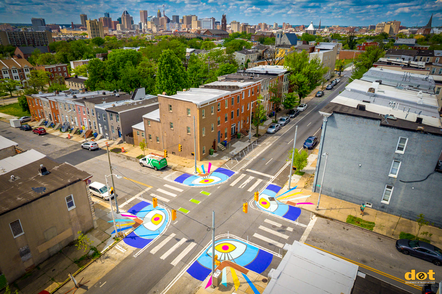
The Allover Eyes traffic calming mural helps East Baltimore’s Oliver neighborhood achieve its long standing goals of beautification and improving pedestrian safety at the historically dangerous intersection of Biddle and Bond Streets. Allover Eyes was created with the Oliver Action Team with support from ReBUILD Metro, the Oliver Community Association, and Baltimore City DOT. Graham Projects completed this project in April 2023.
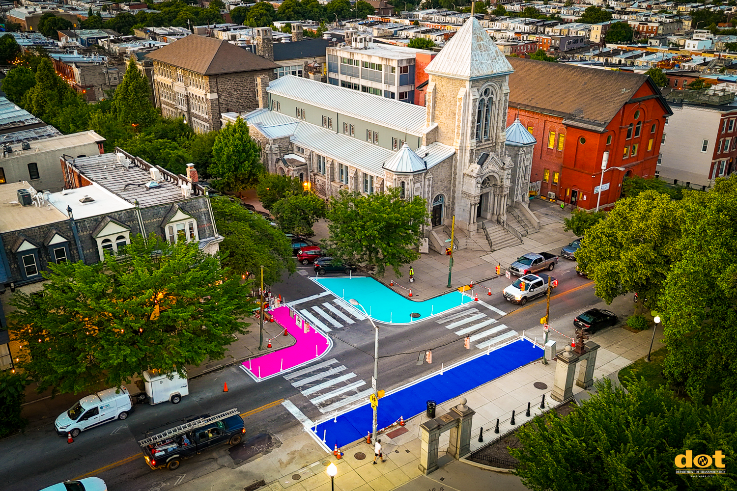
A bold transformation at the intersection of Baltimore St & Lakewood Ave—this permanent public art and streetscape project by Graham Projects, in collaboration with the Patterson Park Neighborhood Association, combines traffic calming with creative placemaking to turn a standard crossing into a vibrant, community-centered space. This project was completed in June 2024.
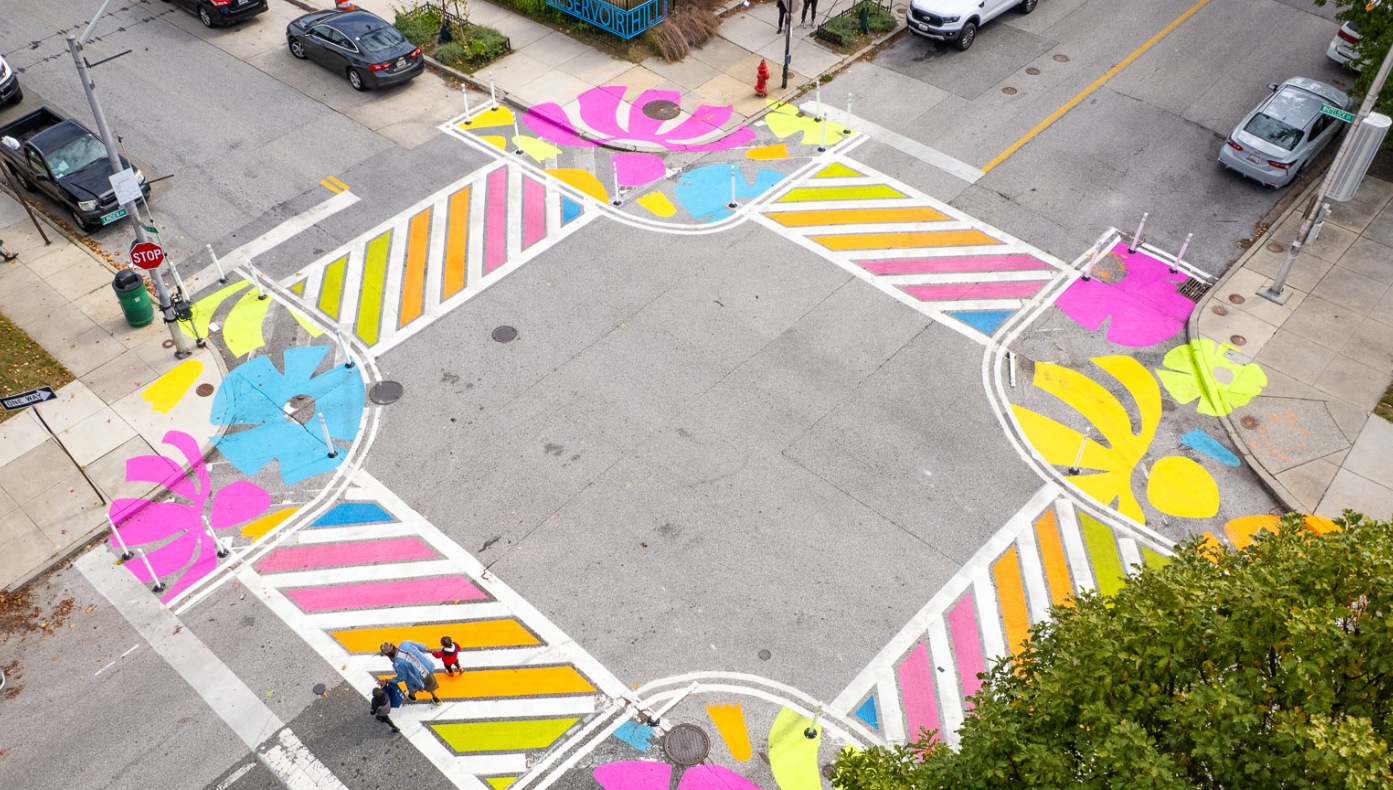
Graham Projects collaborated with Reservoir Hill Improvement Council to create colorful, traffic-calming street art at the intersection of Linden Avenue and Whitelock Street in the Reservoir Hill neighborhood. The chosen concept, Garden Walk, brings the lushness of Maryland native plants from the yard onto the street, creating a vibrant streetscape that’s always in bloom. Bright colors and stylized flowers speak to the adjacent wall mural as well as the floral and nature drawings from the community. This project was completed in October 2025.
City-wide Placemaking GIS Map
Checkout our NEW and updated ------> Placemaking GIS Map <----------
Our interactive GIS Map shows the exact location of every single Placemaking Project in the City, as well as data related to each project. This map layer will continue to be updates as we implement more projects in the city. (Last update 6/10/2026)
Thank you for your contribution!
Help us reach out to more people in the community
Share this with family and friends