The Wolfe-Washington Bikeway Study
Map of Recommendations
The network of recommendations on the map below is a subset of the corridors in the 2015 Bike Master Plan Update. It also identifies corridors for their strategic importance in "unlocking" portions of Baltimore City to low stress bike travel. Corridors that require a separated facility to become low stress are shown in purple. Those where a non-separated facility is adequate are shown in pink. The goal is to complete construction of low stress facilities on these corridors within the next two to five years. The Bike Master Plan identifies additional facilities what are needed to recude out-of-direction travel to the low stress network and reach remaining disconnected neighborhoods.

About this Project
The Wolfe/Washington Bikeway was identified in the 2017 Separated Bicycle Network Plan as a vital mobility connection due to its proximity to jobs, resources, housing, and populations in need of mobility options. Baltimore City currently has 15 miles of separated bicycle facilities installed, 7.3 of which are connected. Installing 2.1 miles of bicycle infrastructure on Wolfe Street or Washington Street will enable new connections to existing separated bicycle facilities on St. Lo Drive and Monument Street, expanding the connected network to 11 miles of high-quality bicycle infrastructure and connecting new households in East Baltimore.
| People and destinations within 0.25 miles | Wolfe/Washington Street Bikeway | 11-Mile Connected Network |
| Population | 16,400 | 62,500 |
| Households | 7,400 | 30,700 |
| Jobs | 25,900 | 87,900 |
| Car-free households | 26% | 36% |
| One-car households | 47% | 45% |
| Public housing buildings | 66 | 200 |
| K-12 schools and childcare centers | 20 | 55 |
| SNAP supermarkets and grocers | 6 | 16 |
| % of people in poverty | 19% | 23% |
| % of people within 200% of the poverty threshold | 36% | 40% |
Current Project Status

Current project activities:
- Field work and data collection
- 60% design process
- Community survey on safety, preferred materials, and placemaking ideas
- Community outreach
Fall 2024 Community Outreach Schedule
*Schedule will be updated continuously with new events. If you would like DOT to come to an event, please send us the event information in the comment box at the bottom of the page.*
Butchers Hill Flea Market 9/14/24District 13 Crab Feast 9/17/24
Traffic Calming Survey

Take the Fall 2024 Wolfe/Washington Survey!
Summary of Previous Work
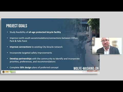
The City of Baltimore Department of Transportation led a feasibility study to determine and develop a preliminary concept of a dedicated bicycle facility on Wolfe Street and/or Washington Street from Aliceanna Street in Fells Point to Sinclair Lane in Clifton Park.
This study was funded by a 2019 Maryland Department of Transportation Kim Lamphier Bikeways Network Program grant. This project studied the feasibility of providing dedicated bicycle lanes along Wolfe Street and/or Washington Street in accordance with the 2015 City of Baltimore Bike Master Plan and 2017 Separated Bike Lane Network Plan. The study period spanned January 2021 through June 2023 and included four public meetings.
Additionally, the City and a consultant team examined existing conditions, such as land use, volumes (pedestrian, bicycle, traffic), and curbside usage, to gain a thorough understanding of the range of possibilities. In June 2023, we concluded the feasibility study and determined a 30% concept design that will provide the foundation for the next phase of preliminary design.
The feasibility study recommended one lane of vehicle traffic with two parking lanes and a protected two-way bicycle facility on Washington Street. Complementary traffic calming recommendations for Wolfe Street include speed bumps, driving lane reduction, and flexible use curb space. The report and design are published in the documents section of this page.

Public Workshop | September 14, 2022
-
Project News & Updates
Share Project News & Updates on Facebook Share Project News & Updates on Twitter Share Project News & Updates on Linkedin Email Project News & Updates linkJoin Us for Our April Public Meeting
Join the City of Baltimore on Tuesday, April 4th, to see the study results, including the proposed 2-way cycle track on Washington Street and traffic calming on Wolfe Street.

Tuesday, April 4, 2023 | 6-7:30pm
Wolfe Street Academy
245 S Wolfe St.
Baltimore, MD 21213
In the Cafeteria • Accessible via CityLink GoldAccommodation needed?
We value inclusion and access for all meeting participants! If you require accommodations, please contact us at least 48 hours prior to the meeting at DOTCivilRights@baltimorecity.gov or 410-361-9720Join Us for Our Third Public Workshop Events
Join the City of Baltimore on Wednesday, September 14th, and Thursday, September 15th, for our third round of public workshops for the Wolfe Washington Bikeway Study.
At each of these meetings, participants will be able to hear more about the project, see the concepts, participate in Q&A, and provide feedback on parking, traffic calming, and more!
Wednesday, September 14th (Virtual)
September 14, 2022 | 1-2:30pm
Join Zoom Meeting:
https://rkk-it.zoom.us/j/87884633107?pwd=Q28wdXJMU3FTUWNicWNoQ3dqbXUxUT09Meeting ID: 878 8463 3107
Passcode: 266117One tap mobile:
+13017158592,,87884633107#,,,,*266117# US (Washington DC)
+13126266799,,87884633107#,,,,*266117# US (Chicago)Dial by your location:
+1 301 715 8592 US (Washington DC)
+1 312 626 6799 US (Chicago)
+1 646 931 3860 US
+1 929 436 2866 US (New York)
+1 309 205 3325 US
+1 386 347 5053 US
+1 564 217 2000 US
+1 669 444 9171 US
+1 669 900 6833 US (San Jose)
+1 719 359 4580 US
+1 253 215 8782 US (Tacoma)
+1 346 248 7799 US (Houston)Meeting ID: 878 8463 3107
Passcode: 266117
Find your local number: https://rkk-it.zoom.us/u/kLuFRH4AVThursday, September 15th (In-Person)
September 15, 2022 | 6-8pm
Humanim
1701 N. Gay Street
Baltimore, MD 21213
View on Google MapsJoin the City of Baltimore on Thursday, February 25, 2021 for a 2nd Virtual Public Workshop. We will present design concepts for your feedback.
After a short presentation of the design options, we will break into small groups for discussion and commenting using an online visual collaborative tool.
A link to the virtual meeting will be sent to you upon registration. We recommend using a computer or a tablet to participate in the exercise or call in to be a part of the discussion. Meeting materials and a summary of the meeting will be posted to the Project Resources page after the meeting for additional commenting.

Registration is not necessary to attend but we encourage doing so to improve preparation for small group conversations. Call in information is provided here:
+1-408-418-9388, 1794425230## United States Toll
+1-646-992-2010, 1794425230## United States Toll (New York City)Meeting number (access code): 179 442 5230
Meeting password: A4mkrCXPg63The City of Baltimore held a Virtual Listening Session introducing the Wolfe-Washington Bikeway Study.
On the evening of Thursday, January 21, 2021 at 6:00pm, City staff and their team held a virtual introduction to the Wolfe Washington Bikeway Study. The team introduced the goals and timeline of the study, provided an educational introduction to bicycle infrastructure, and solicited feedback from the communities and residents surrounding Wolfe Street and Washington Streets, from Aliceanna Street in Fell’s Point to Sinclair Lane in Clifton Park. Community input was used to inform the team conducting the study about community priorities, concerns, and design preferences.
Wolfe Washington Bikeway Study – Public Meeting #1


Public Meetings and Workshops Presentations
-
 Wolfe-Washington-Public-Meeting-3-Presention (1.86 MB) (pdf)
-
Wolfe-Washington-February-Presentation_reduced.pdf (3.39 MB) (pdf)
-
Wolfe-and-Washington-Bikeway-Public-Meeting-2-Chat.pdf (181 KB) (pdf)
-
Master-Wolfe-Washington-January-Presentation_reduced.pdf (5.48 MB) (pdf)
-
FINAL_HighRes_Separated-Bike-Lane-Network_4_7-compressed.pdf (3.23 MB) (pdf)
-
Wolfe and Washington meeting 4 Presentation (5.19 MB) (pdf)
-
Wolfe_Washington_Meeting_#4_Summary_0407.docx (17.2 KB) (docx)