Wabash Ave Multimodal Improvements Study
About this study
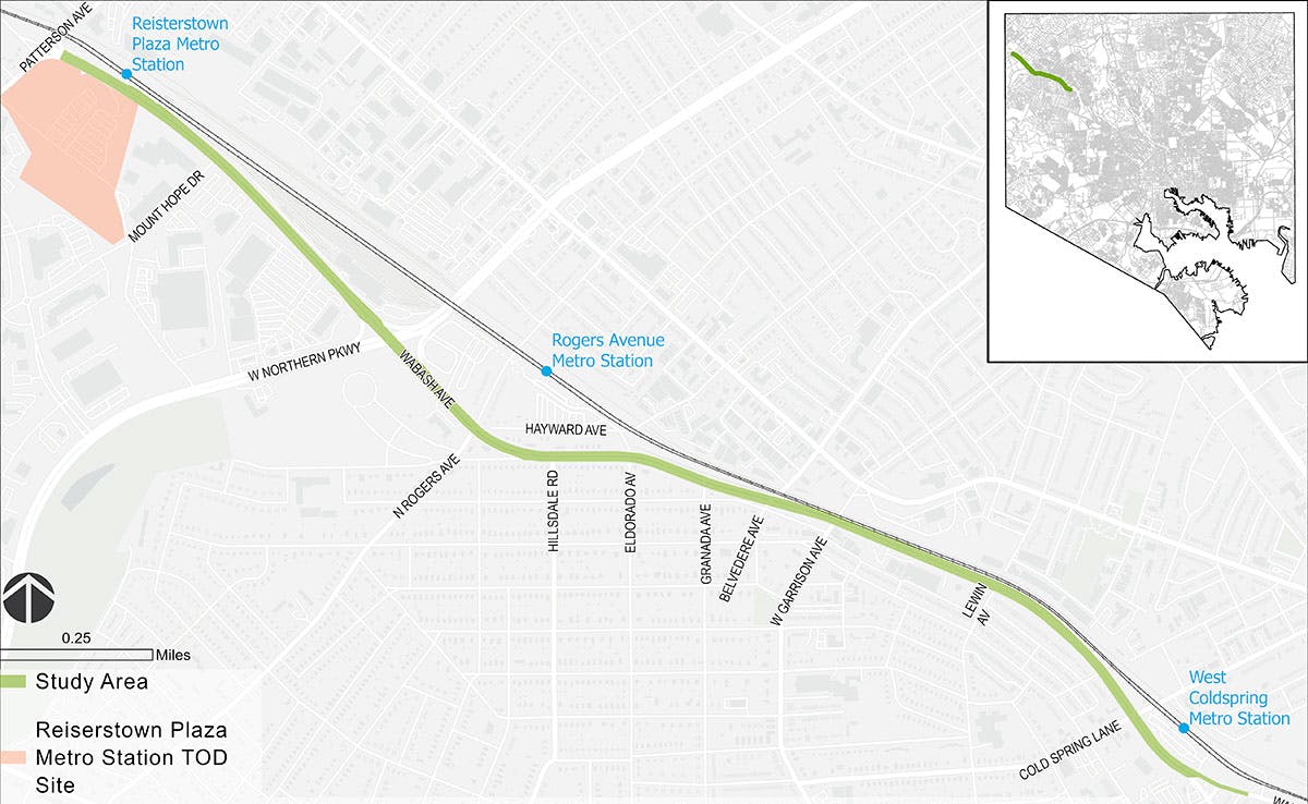
With technical assistance from the Baltimore Metropolitan Councils' Transportation Land-Use Connections Program, the Baltimore City Department of Transportation (BCDOT) is leading a feasibility study for a separated bike lane within the Wabash Avenue corridor. The study will include but is not limited to review of existing conditions, review of surrounding land-uses for Complete Street typology assignment, assessment of residential parking needs, proposal of bikeway design alternatives, analysis of crashes and 311 requests, and preliminary analysis of intersection movements. The result of this effort will be 30% concept plan, corridor planning document, and a cost estimate of construction for a dedicated bicycle facility on Wabash Avenue. The proposed project bounds are West Cold Spring Lane adjacent to the West Cold Spring Metro Station and Patterson Avenue adjacent to the Reisterstown Plaza Metro Station and transit oriented development site. This study will be conducted in accordance with the 2018 Complete Streets Ordinance, 2015 City of Baltimore Bike Master Plan, and 2017 Separated Bike Lane Network Plan.
This study is supported by a 2022 Baltimore Metropolitan Council (BMC) Transportation & Land Use Connections (TLC) grant through the BMC's Baltimore Regional Transportation Board (BRTB). The TLC program has provided short-term technical assistance to support BCDOT in their planning and preliminary design efforts to implement changes to the Wabash Avenue corridor to reduce traffic on roads and enable more people to easily walk, bike, and use transit. The goal of the potential bicycle facility will be to provide increased connectivity to the Greater Northwest Community from the West Cold Spring Metro Station/Hilton Road Separated Bike Lane and connections to current and future bicycle facilities within the City through the implementation of a safe, low-stress bicycle environment.
Beginning in February 2023, the City and their team will actively collaborate with residents, community members, institutions, businesses, and agency partners through three formal rounds of engagement to educate, listen, inform, and understand their concerns, priorities, and preferences.
The study will conclude in summer 2023 with the publication of study findings. The study will provide the foundation for the next phase of preliminary design and community engagement feedback needed prior to construction and implementation.
The Scope
The City of Baltimore will lead this planning and engagement exercise to determine how dedicated bicycle facilities can be added to Wabash Avenue. To perform this planning, the City and the team will examine existing conditions – understand existing land use, determine existing volumes (pedestrian, bicycle, traffic), and evaluate curbside usage – to gain a thorough understanding of the range of possibilities.
Join the Process
The City will work collaboratively with you and your neighbors, peers, local businesses, and institutions to navigate a planning process aimed at arriving at a consensus solution to provide greater connections through the Greater Northwest corridors and to the City of Baltimore Bike Network.
Check back to this website regularly for specific meeting dates and opportunities and follow the City of Baltimore Department of Transportation social media channels for more information.

Wabash Avenue Existing Right of Way

Wabash Avenue Concept Sections
(Proposed Drafts as of February 2, 2023)
THESE CONCEPTS ARE NOT FINAL AND WILL EVOLVE OVER THE COURSE OF THE PLANNING PROCESS


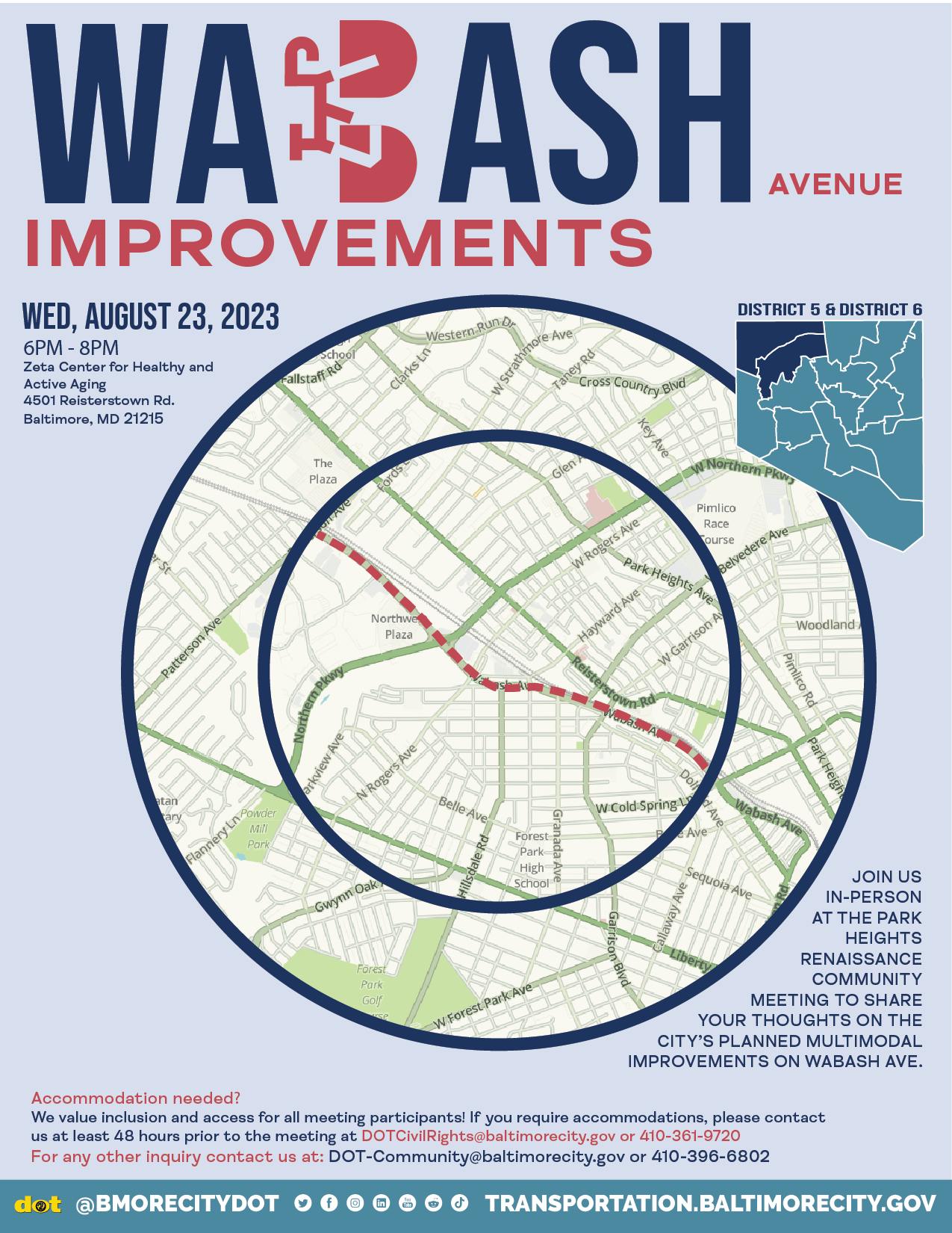
Public Meeting # 3
August 23, 2023
Part 1: Foundation
Where does the idea begin?
Previous planning documents, grant application, project goals:

Project Goals
- Limit/Avoid Impacts to:
- Parking
- Driveways
- Utilities
- Traffic Signals
- Traffic Flow
- “Quick Build”
- Signage, pavement markings, delineators/flex posts
- Concrete/curb improvements only where needed to improve safety
Considerations
- Improved Safety to Walk, Bike, and Drive on Wabash Avenue
- Shorter Crossings for Pedestrians
- Community Input
- Connectivity
- Existing and planned multimodal facilities
- Key community resources
Where are we now?
What comes next in the concept development and final design process for Wabash Ave:

Wabash Avenue Community

Part 2: How does Wabash Avenue Become a Great Street?
Urban Center Connector
Urban Center Connectors (UCC) can be streets that are identified as truck routes and/or frequent transit routes which also has a high level of pedestrian traffic. Design of a UCC must consider the needs of larger vehicles while prioritizing pedestrian safety and providing safer and comfortable bicycle accommodations.
Typology (noun) ty•pol•o•gy
Typology is the classification of roadway types. In transportation engineering, typology refers to the task of grouping roadways according to the similarity of their essential characteristics.

Focus of Improvements
- Pedestrian Safety
- Bicycle Network
- Traffic Calming

Common Improvements on Urban Streets
- Signage and Pavement
- Marking Improvements
- Traffic Light Timings
- Bicycle Lane
- Vertical Separation
- Shared Use Path
- Crosswalk Signals
- Sidewalk Improvements

Part 3: How We Got Here
Community Involvement So Far
Public Involvement Meeting #1: February 2, 2023 • Virtual
The purpose of the meeting was to provide the public with the project history, scope, and schedule the project will follow. We asked:
What do you love about Wabash Avenue?
- Subway stations
- Serves as a good connection
Do you prefer a meeting in person?
- In-person meetings: 78%
- Vitual meetings: 0%
- Unsure / No preference: 22%
Public Involvement Meeting #2: April 18, 2023 • In-Person, Forest Park High School
Listening to the feedback we received at Public Involvement Meeting #1, this meeting was held in person. As a result of the feedback we received at Public Involvement Meeting #2, the project’s scope was expanded to include improvements for a broader cross-section of the community.

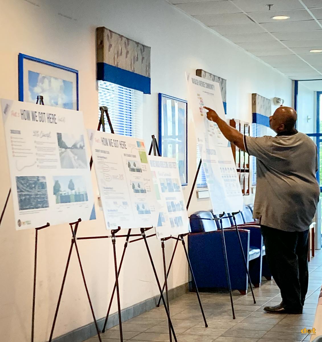
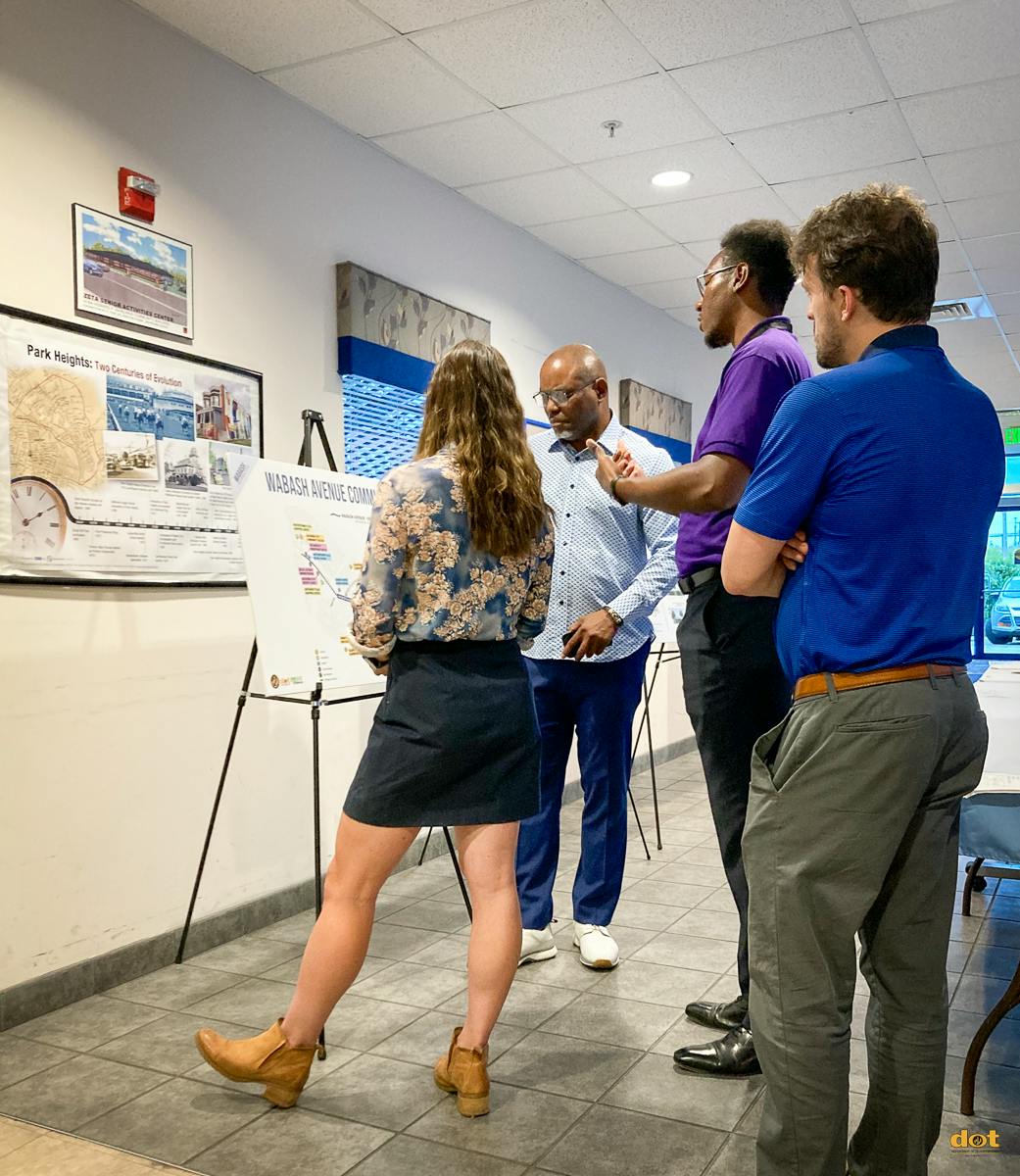
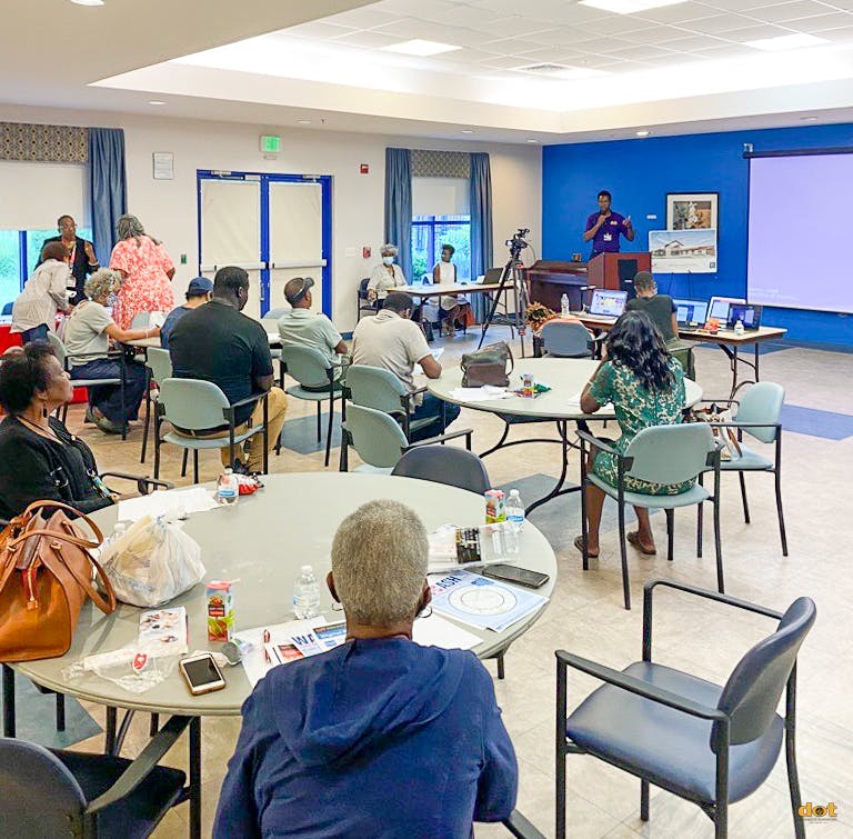
Public Involvement Meeting #3: August 23, 2023 • In-Person Open House, Zeta Center
Community feedback has taught us to expand involvement of community stakeholders and agency partners for a more inclusive design process.
- Department of Planning
- Park Heights Renaissance
- Looking for additional community partners
How to Reimagine the Roadway


Considerations
- Improve Safety for All Travelers
- Contextual Fit Within the Community
- Minimize Parking Impacts
- Align With a Proposed Long-Term Vision of Wabash
- Create Connections With Transit Stations and Bus Stops
- Close Sidewalk Gaps for Pedestrians
The Complete Streets Manual provides guidance on how to balance the roadway for all travelers.

A parking analysis was performed on Wabash Avenue from Hillsdale Road to El Dorado Avenue. Alternative One and Three resulted in parking losses.
30% Concept
- Organizing Different Travelers in Their Own Spaces Helps Provide Predictable Movements
- Improving Access and Mobility for Pedestrians, Bicyclists, Scooter Users, People With Strollers, and Mobility Devices Enables Safer Connections to Transit, Shopping, Recreation, and More
- Placement on the North Side of the Roadway Results in Zero On-Street Parking Loss
- Creating Organization, Improving Traffic Movements, and Defining Spaces for Pedestrians Lays the Groundwork for a Neighborhood Oriented Street
- Improving Intersections Provides Clearly Defined Spaces for Pedestrians and Bicyclists to Safely Cross Wabash Avenue


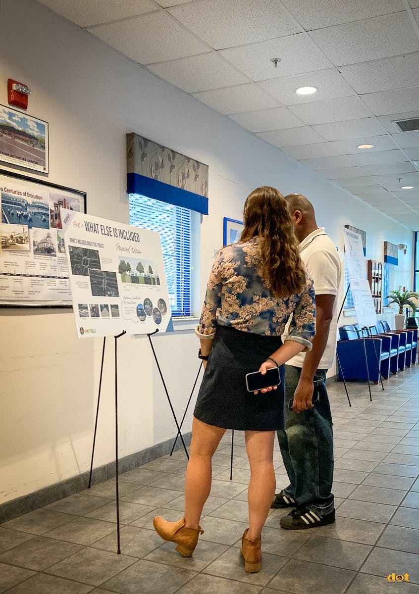
Part 4: What Else is Included
What’s Included Under This Project
- ADA Ramps
- Pedestrian Signals
- Sidewalk Improvements
- Two-Way Shared Use Path


Proposed Vision

Improving Conditions & Connections
This project is an opportunity to improve conditions and connections for people who walk, ride bikes, and use mobility devices.
- Transit Shelters
- Bike Racks
- Benches
- Trees

Public Meeting # 2
April 18, 2023
Public Meeting # 1
February 2, 2023
Watch the video to review the presentation or download the PDF from the Public Outreach Documents tab from the Public Meeting on February 2, 2023.
Download the PDF from the Public Outreach Documents tab to review the Slido survey results from the Public Meeting on February 2, 2023.

Meeting Flyer
Photos
Related Documents
-
 Supporting Documents
-
Public Meeting #1
-
Public Meeting #2
-
 April 18, 2023 Public Presentation (5.64 MB) (pdf)
-
Open House Sign-in sheet (3.4 MB) (pdf)
-
Open House Comment Card (36.5 MB) (pdf)
-
Open House Board 1- Project Foundation (31.6 MB) (pdf)
-
Open House Board 2 - What is Great about Wabash? (43.4 MB) (pdf)
-
Open House Board 3 - Design Tools (39.2 MB) (pdf)
-
-
Public Meeting #3


