28th Street Multimodal Connection Concepts
The 28th Street Project is now complete!
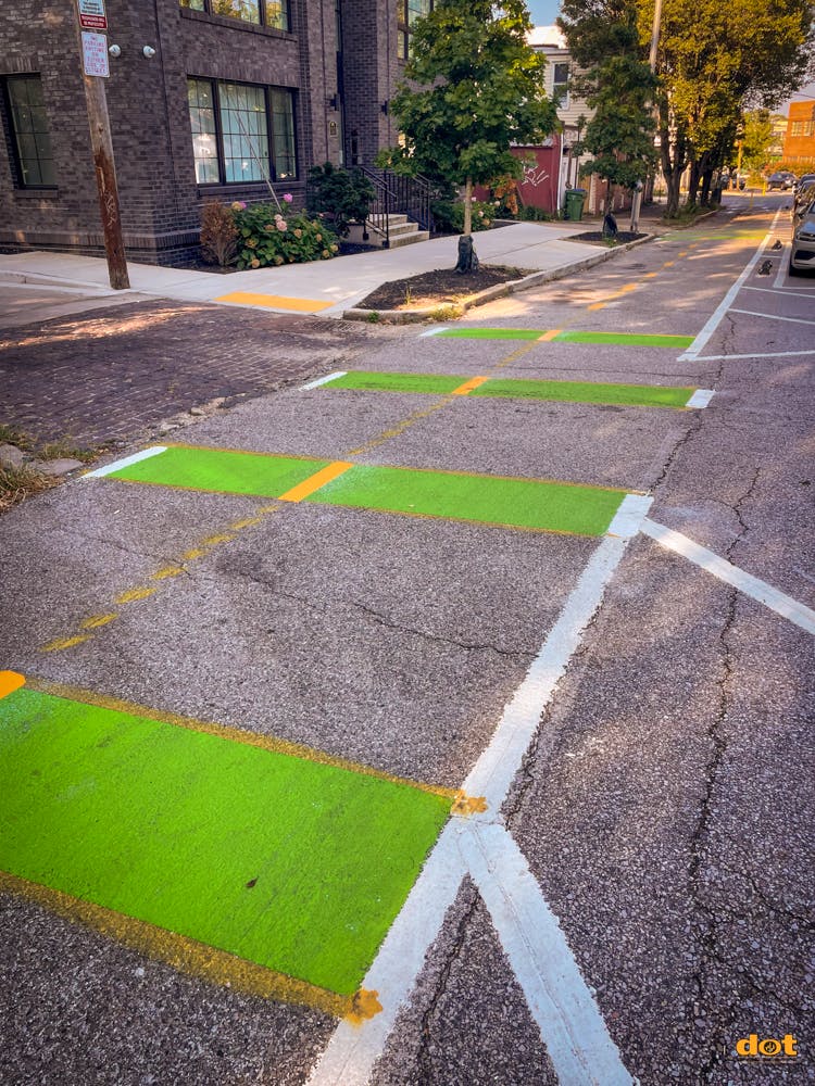
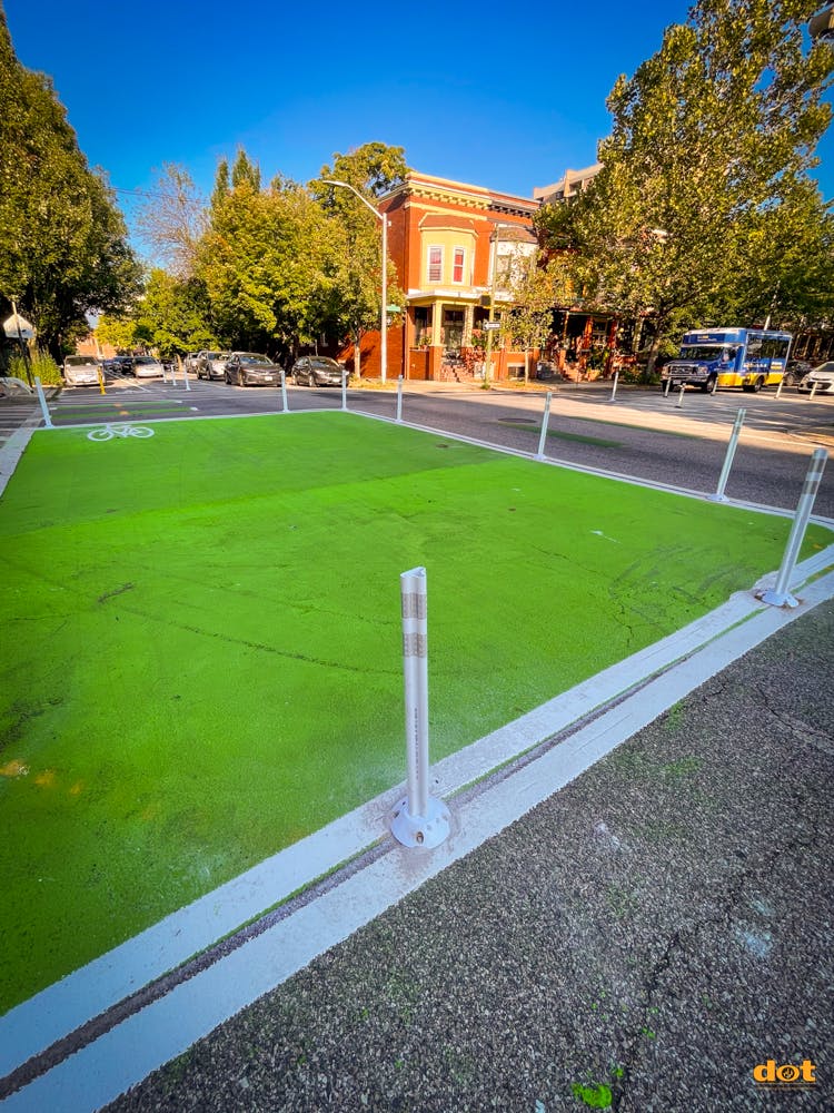
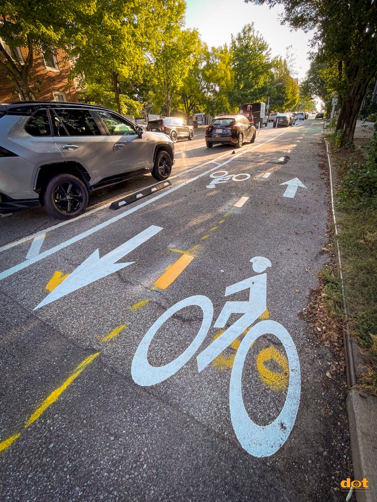
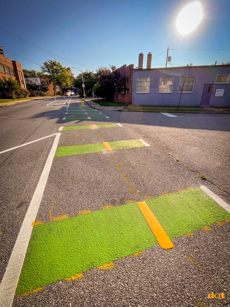
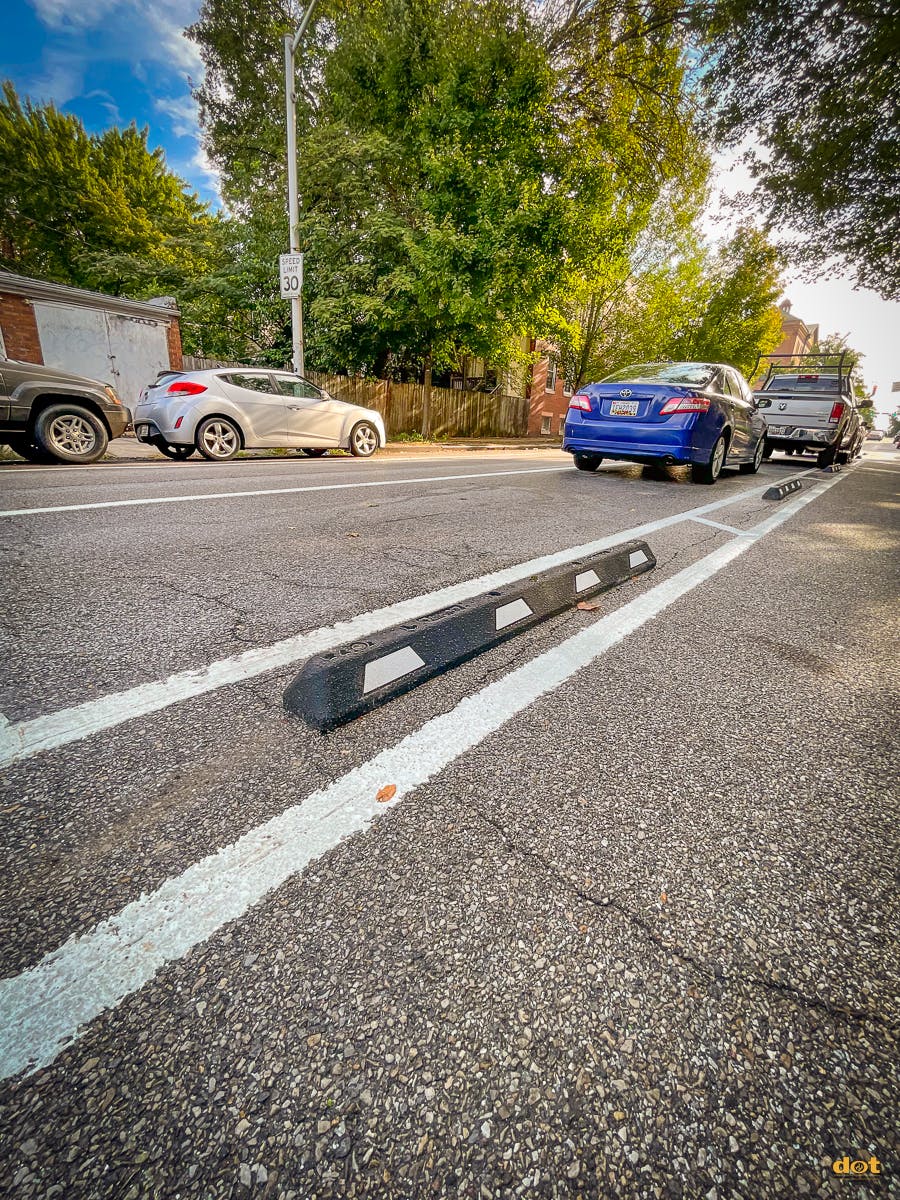
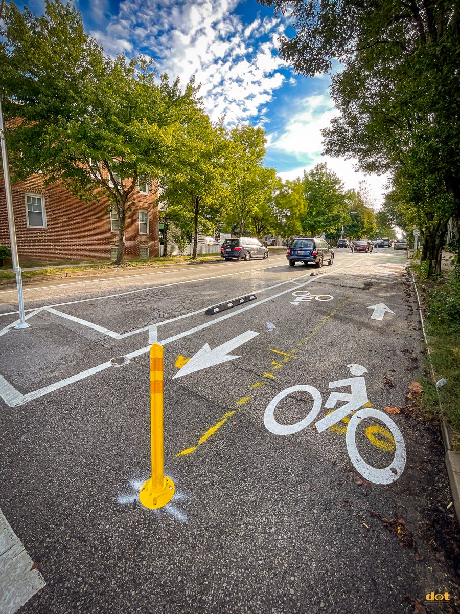
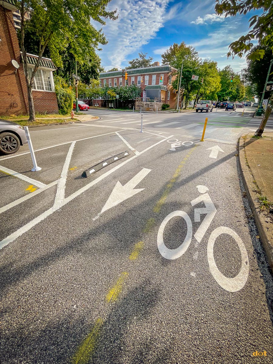
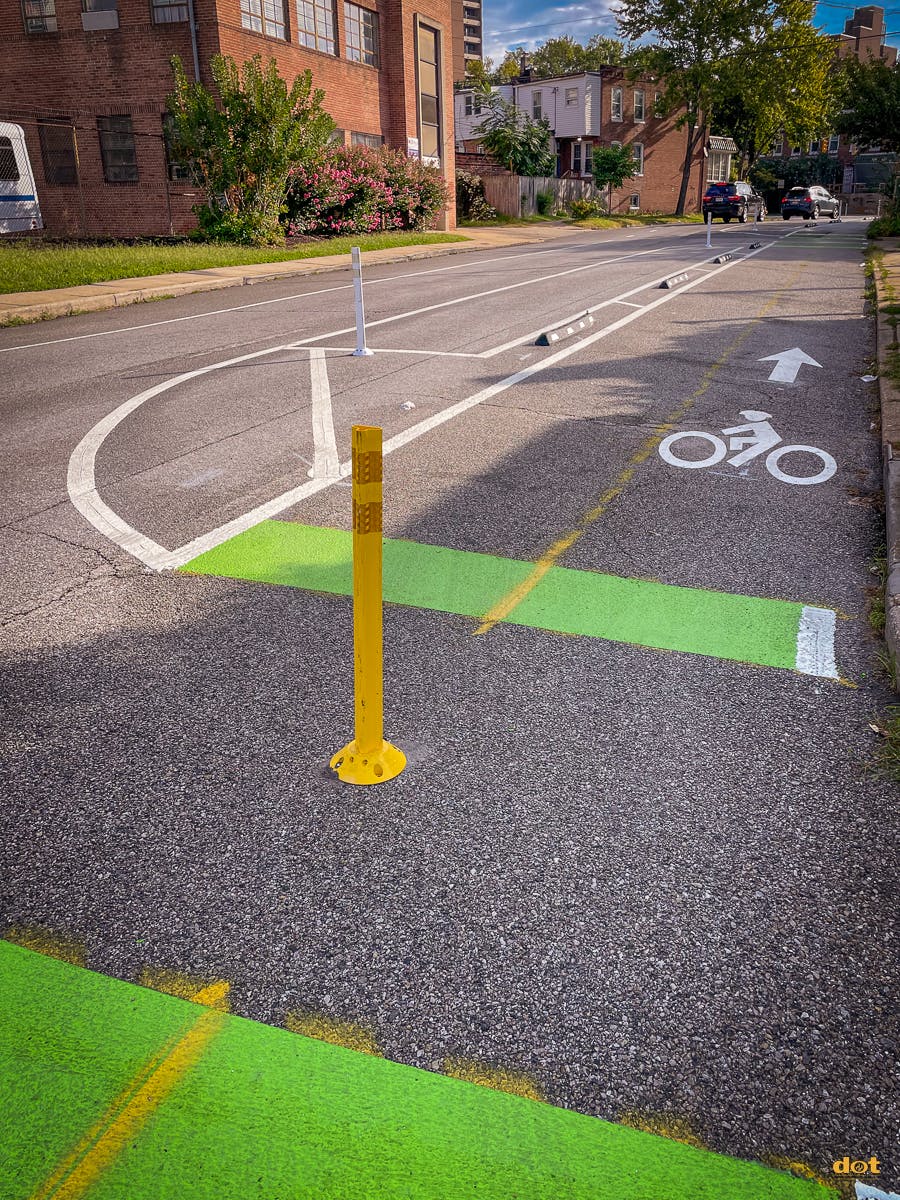
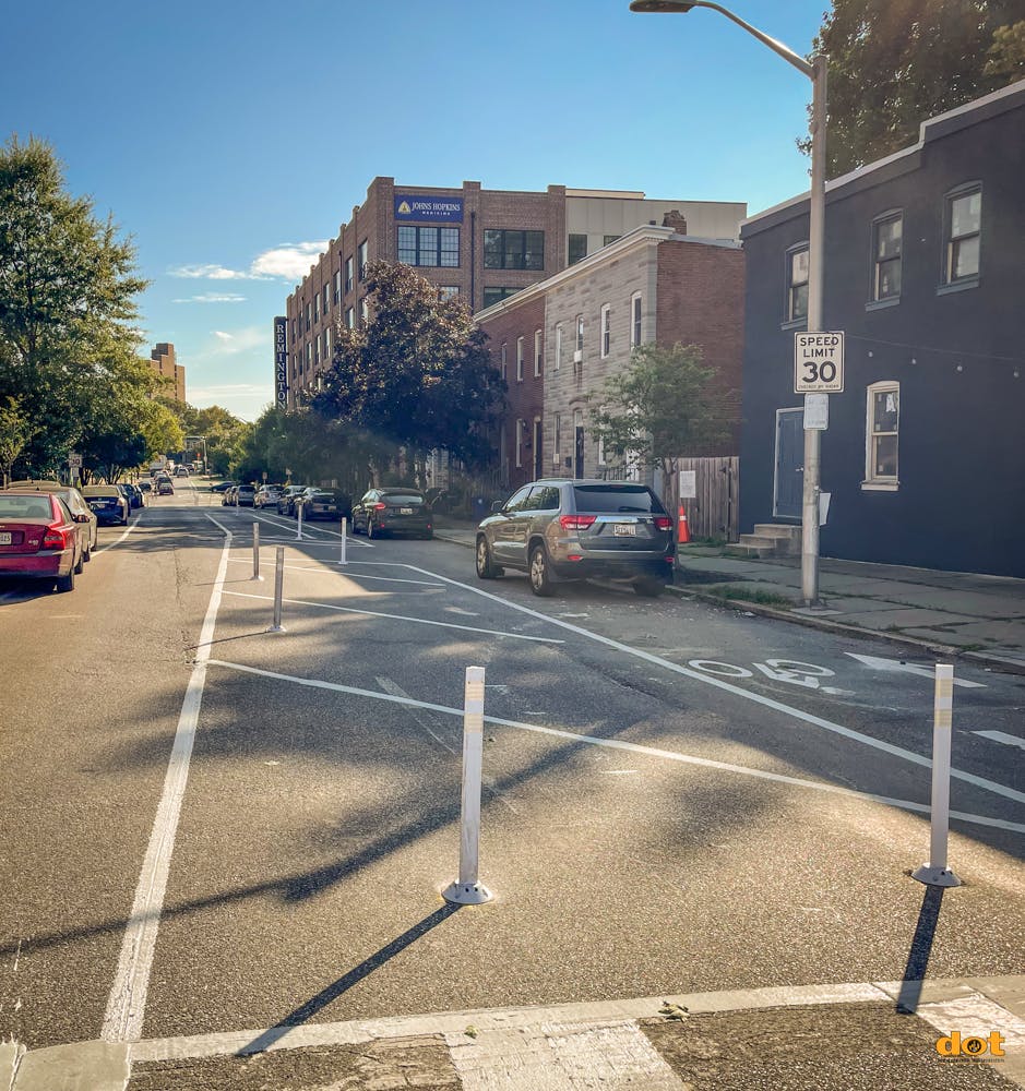
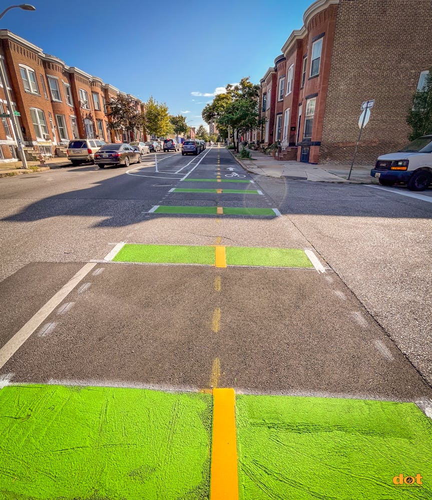
As part of the Road Diet initiative, two travel lanes on W 28th St, between Sisson St and Maryland Ave, have been consolidated into a single lane for vehicles. A two-way bike/scooter facility with floating parking has also been added. The parklet at Huntington Ave was preserved by adjusting the lanes. Additionally, new crosswalks, stop bars, and flex posts have been installed along the corridor.
We extend our gratitude to all partners and community members involved in making this project a success!
 |  |  |
 |  |  |
 |  |  |
 |  |  |
 |  |  |
 |  |  |
 |  |  |
 |  |  |
 |  |
Sep 6, 2023 Update
Work on the 28th Street Multimodal Connection Concepts is just about DONE!
We've added the yellow divider striping, and have finished installing all the flex posts.
 |  |
 |  |
Aug 22, 2023 Update
On Monday, we began painting in the 28th St Bike Lane. Don't park in it, you will get a ticket!
 |  |
 |  |
Aug 21, 2023 Update
We began painting in the 28th St Bike Lane. Don't park in it, you will get a ticket!
 |  |
 |  |
Aug 17, 2023 Update
Our crews got a lot of work done forming the bump-outs along 28th St and painting the crosswalk at 28th and Sisson.
 |  |
 |  |
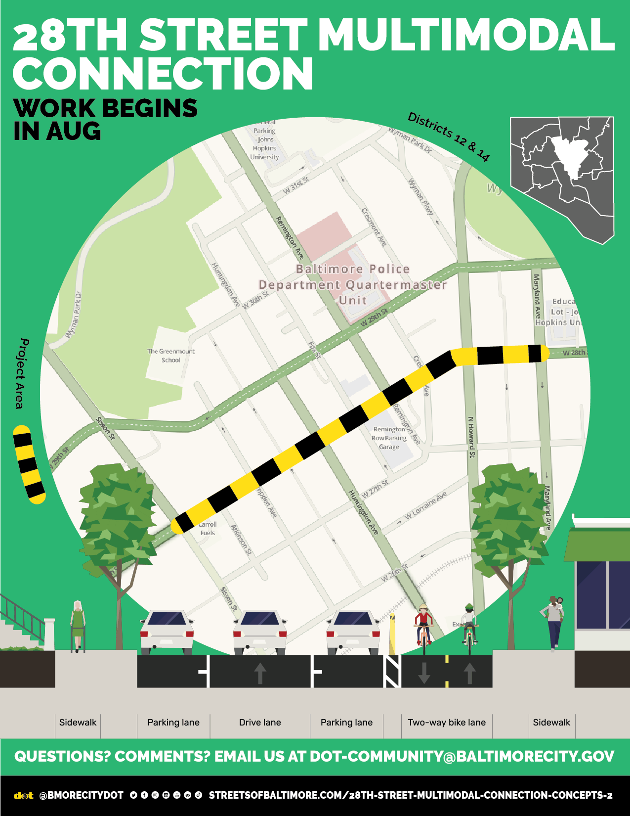
Work begins on the 28th St Multimodal Connection in August! Questions? Comments? Email us at DOT-Community@BaltimoreCity.gov
What is Being Built:
Alternative 1 (The Road Diet) was determined as the preferred option through discussions with the community and the surveying performed. The “Road Diet” will reduce W 28th St between Sisson St and Maryland Ave to one vehicular travel lane. The existing parklet at Huntingdon Ave will remain by shifting the two-way bike facility and travel lanes around it (Parklet Option 2). Work will commence the week of August 7th and will continue for approximately a month.
Alternative 1 (Road Diet)

Converts the two travel lanes on 28th Street between Sisson St and Maryland Ave into one travel lane.
Addition of two-way bike/scooter facility with floating parking

Parklet Option 2: Shifting Bike and Travel Lanes Around Existing Parklet to Maintain Public/Community Space
Baltimore City Department of Transportation will present concepts for a quick build bicycle connection on 28th Street from Sisson to the Maryland Avenue Cycle Track.
The Project boundaries are 28th Street from Sisson Street to Maryland Avenue.
Signal timing adjustments on 29th Street will be made as needed to coordinate with any changes on 28th Street.
Full Presentation from March 1st:
Current Partners
Central Baltimore Partnership
The Greater Remington Improvement Association
Maryland Department of Housing and Community Development
Project Background & Goals
- Traffic safety concerns on 28th Street between Huntingdon Ave and Maryland Ave.
- DOT examined traffic operations on both 28th and 29th Streets between Sisson and Charles Street
- Design goals:
- Reduce average speed
- Provide safe and convenient access for pedestrians and cyclists: of all ages and abilities facility
Study Area
 W 28th St (Between Sisson St and Charles St)
Existing Lane Configuration

- Two travel lanes with parking on both sides
- Wide lanes in some sections (contributes to high speeds)
- Narrow lanes in other sections (contributes to sideswipes and bad sight distance)
Proposed Alternative 1 (Road Diet)

- Convert the two-lanes on 28th Street between Sisson Stand Maryland Ave into one-lane
- Addition of two-way bike/scooter facility with floating parking
 Install an exclusive right turn lane at 28th and Huntington Ave
Level of Service and Capacity Analysis
- Operational Analysis Tool: Synchro Software Version 11
- Measure of Effectiveness: Delay and Queue
- Level of Service (LOS) - A qualitative measure describing operational conditions within a traffic stream


- Existing Cycle Lengths:
- 110 seconds – AM
- 90 seconds – MD
- 100 seconds – PM
- Existing Peak Hour Volumes
- Turning movement counts (TMC) conducted in November 2022
AM Peak Hour Volumes & Existing LOS


Proposed Configuration (ALT 1)

- Used Existing Cycle Lengths:
- 110 seconds – AM
- 90 s seconds – MD
- 100 seconds – PM
- Installed:
- 100 ft exclusive RT lane at 28th and Huntington Avenue
- 100 ft exclusive LT lane at 28th and Howard Street
AM LOS Comparison (ALT 1)
 MD LOS Comparison (ALT 1)
 PM LOS Comparison (ALT 1)

- Reduces vehicular speeds
- Shortens pedestrian crossing distance
- Increases pedestrian comfort and visibility
- Bike/scooter/mobility chairs connectivity
- Some smaller parking impacts
- Reduction in road volume capacity
Proposed Alternative 2

- Retain two-lane configuration with some lane width narrowing
- Addition of two-way bike/scooter facility with reduction of parking
Level of Service and Capacity Analysis, Alternative 2

Potential Results of Alternative 2
- Upgraded signal timing
- Helps reduce vehicular speeds through lane narrowing
- Maintains roadway capacity
- Bike/scooter/mobility chairs connectivity
- Larger parking impacts
 Install an exclusive left turn lane at 28th and Howard St
Update May 17, 2023

Red Circles
Alternative 1 - Parking Lane
Alternative 2 - Driving Lane
Proposed Alternative 1 – Typical Plan View

Parklet Alternatives

28th and Howard Configuration

Apologies for the March 1st Meeting
To all Attendees, Civic Organizations, Elected Officials, and Private Residents who attended last night’s 28th Street Multimodal Connection Concepts Public Meeting.
We Apologize.
We understand that the time you take out of your day to attend a public meeting is time away from your friends, family, and professional obligations and that time is sacred. We want to sincerely apologize to the participants for the level of service they received and those who did not receive an adequate response to their questions and concerns.
At the BCDOT, we have traffic engineers and policy professionals, and the line between technical and too technical is often blurred. The goal is and should always be clarity and comprehension. Without that, it is very much a one-sided conversation. This was an opportunity to show the people who care most about this project, the progress the agency has made, however, we regret we did not rise to that occasion. We need to build trust, and can’t do that without complete transparency, especially when we screw up.
So, What Happened?
Many People Were Not Heard!
- We had many technical difficulties and the meeting was cut short. This resulted understandably in many people feeling confused, frustrated, and upset. While technical difficulties happen, we could have communicated about the issues on the call and managed them better.
- We are reviewing our public meeting settings, staffing, and software options to avoid this moving forward. You deserve a more streamlined experience and we will make it happen.
- There were pressing questions about meeting grant deadlines and the opportunity for specific people to speak.
- We are meeting these questions head-on
- We are dedicating multiple staff to addressing comments, questions, and concerns that were raised during the public meeting itself or will be submitted in the form below for the official open comment period. These questions will receive the diligence and respect they deserve.
On the Public Comment Period:
- Residents wanted to know why the comment period would start next week instead of immediately. We heard your feedback and corrected this. All comments on the preferred option can be submitted HERE.
- The Presentation is available with the traffic-related options and we have engineers on stand-by to answer questions if you need clarification before submitting a preferred option, you can contact them here: DOT-Community@baltimorecity.gov
The goal was to present all traffic options clearly, troubleshoot live questions about those options, and answer outstanding concerns. An iterative deliberative process is the only way to ensure the options are representative of the diversity of the people and organizations who have been partners in this process.
We are sorry we haven’t been a better partner and understand the urgency of the moment. Thank you for showing up, and speaking up. Updates on the meeting and the project status can be found on this page.